advance it like a demo ▸
Maria Fire lands it real
This is alert.live.
Watch the actual workflow, one step at a time — from the alert on a citizen's phone to a shared, georectified picture.
Step 1 · the alert arrives
⚠ EVACUATION WARNING
Fast-moving fire reported near your location. Open the live map centered on you.
🗺 map.alert.live/you ▸
Step 2 · tap → map centered on you
you
Step 3 · open camera → georectify live
LIVE
◈ frame locked to map
The frame snaps to the map
Point the phone. The camera view georectifies in real time — a map horizon and graticule lock onto the scene.
Step 4 · annotate a feature
LIVE
spot fire ↗
Mark what you see
Draw on the georectified frame. The annotation is placed in real-world coordinates for everyone on the layer.
Step 5 · choose a layer
Private — just you, drafting
Group — your crew & command
Public — the shared operating picture
Share on purpose
Promote a picture private → group → public when it's ready.
Step 6 · 2D ↔ 3D
2D mapplan view
3Dterrain view
Flip the vantage
Same georeferenced truth, seen flat or in 3D terrain.
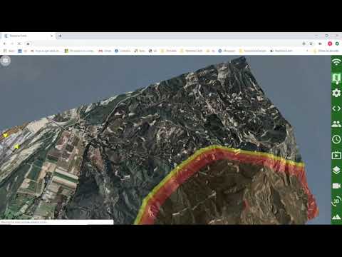
See it real · 2019 Maria Fire
▶
2019 Maria Fire — alert.live in a real incident
Now watch it fielded
The same workflow, running live during the Maria Fire.
SKETCH · the OPEN QUESTION here: should the landing show the product workflow this literally (demo-first) — or lead with vision/outcome and keep the walkthrough lower on the page?